
Mena3D GmbH
Booth number: 8735
www.mena3d.com
About us
Mena3D is a European-based company with headquarters in Regensburg, Germany and several offices in the Middle East and North Africa. We specialize in 3D scanning measuring solutions, and provide the latest state of art technology including (but NOT limited to) reverse engineering, inspection, quality control and GD&T measurement. We offer traditional surveying applications including GPS, GIS, UAV, and 3D laser scanning and software for many applications.
We support our customers by providing the right solution, which can fit their application and help them to use it.
Address
Baeckergasse 41
93059 Regensburg
Germany
E-mail: contact@mena3d.com
Phone: +49 9415 6998278
Internet: www.mena3d.com
Jafza One Bldg., 11th Fl., Office A1100
Dubai
United Arab Emirates
E-mail: sales@mena3d.com
Phone: +971 287 28014
Internet: www.mena3d.com
Contact person:
Dr. Khaled Nabbout
General Manager
E-mail: k.nabbout@mena3d.com
Phone: +49 941 56998278
Products & Services
MENA3D is a European-based geospatial and metrology solutions provider headquartered in Regensburg, Germany, with offices across the Middle East and North Africa. The company supplies and supports advanced technologies for 3D scanning, surveying, UAV mapping, GIS, BIM, reverse engineering, inspection, quality control, and GD&T measurement, helping customers select, deploy, and use the right solution for their application.
Product Portfolio
Geospatial solutions: Traditional surveying systems, GPS/GNSS, GIS, UAV mapping, 3D laser scanning, mobile mapping, unmanned scanning, UAV payload sensors, and geospatial software.
Metrology solutions: Handheld 3D scanners, portable measuring arms, coordinate measuring machines, video measuring systems, large-volume metrology, X-ray and CT inspection systems, and industrial measurement software.
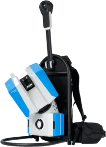
Hovermap ST-X
Hovermap ST-X is a versatile SLAM-based LiDAR mapping system from Emesent designed for fast, accurate data capture in complex and GPS-denied environments. With up to 300 m sensing range, high-density point clouds, IP65 weather-sealed construction, and flexible deployment as a drone-mounted, handheld, backpack, or vehicle-based scanner, it enables safer inspections, faster as-built documentation, and reliable 3D mapping above ground, underground, indoors, or outdoors.
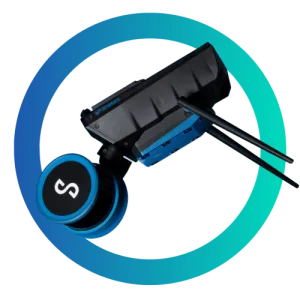
Emesent GX1
Emesent GX1 gives surveyors what they've been asking for: mobile scanning speed with accuracy you can rely on, time and time again. Delivering 5-10mm global accuracy with integrated premium RTK georeferencing, GX1 eliminates the choice between fast scanning and accuracy you can trust - with GX1, you get both.
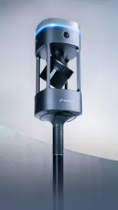
Z+F Imager 5024 Series
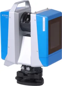
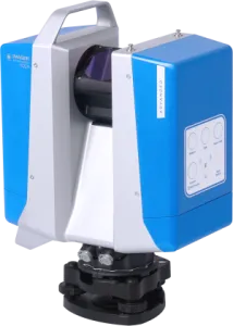
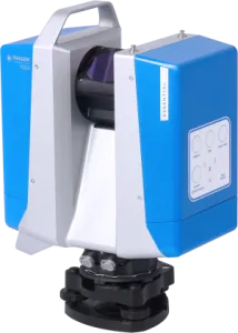
The Z+F IMAGER® 5024 Supreme is a 3D laser scanner that meets the highest demands in complex surveying projects. It impresses with maximum flexibility, stability, and precision, both in close-range and mid-range applications up to a range of 365 meters. Thanks to its versatile features, it is suitable for a wide range of applications.
The Z+F IMAGER® 5024 Advanced is a 3D laser scanner specifically designed to meet the demands for speed and efficiency in surveying projects. With maximum flexibility, stability, and high quality, it excels in both close-range and mid-range applications, with a range of up to 150 meters. Thanks to its versatile features, it is well-suited for numerous applications.
The Z+F IMAGER® 5024 Essential is a 3D laser scanner specifically designed for efficiency in surveying projects. With maximum flexibility, stability, and high quality, it performs well in both close-range and mid-range applications, with a range of up to 80 meters. Thanks to its versatile features, it is ideal for simple applications.
Riegl VZ-600i
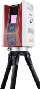
The RIEGL VZ-600i offers a broad range capability from 0.5 m up to 1000 m and is suitable for indoor and outdoor 3D mapping applications. 3D position accuracy of 3 mm, less than 30 sec scan time for high-resolution scans with 6 mm point spacing at 10 m, enabling more than 60 scan positions/hour with real-time registration, weight less than 6 kg (13 lbs), 2.2 MHZ PRR, three internal cameras & GNSS integrated, and also prepared for mobile mapping applications – these key features will speed up your workflow in indoor and outdoor applications.
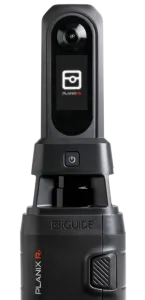
Planix R1
The PLANIX R1 is a professional-grade scanning camera built for real estate professionals, appraisers, inspectors and insurance adjusters. One visit. Complete property data.
Walk through a property room by room. The PLANIX R1 produces 3D virtual tours, accurate floor plans, room-by-room measurements and property reports. Automatically.